

FOLDSCAPE
A procedural urban landscape shaped by
density, accumulation, and spatial pressure.
Foldscape
A procedural urban landscape shaped by density, accumulation, and spatial pressure.
Foldscape is a speculative urban visualization project that transforms OpenStreetMap building data into folded architectural landscapes. Building height and spatial density drive procedural deformation, causing urban forms to stretch, twist, and accumulate. Rather than reconstructing the city literally, the project treats density as a spatial force and explores how urban data can generate emergent spatial forms.

Urban Pressure as Form
Foldscape interprets urban density as a force acting on architecture. Buildings bend, stretch, and accumulate until the skyline becomes a compressed terrain. The resulting landscapes are not simulations of real urban conditions, but speculative forms generated through procedural rules

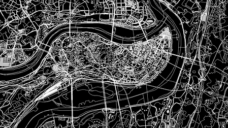
Open Street Map
System
The system transforms urban geometry through multiple stages:
-
OSM building extraction
-
height-based analysis
-
spatial scattering
-
volumetric trail generation
-
procedural folding and vertical stretching


Visual Development
Early procedural studies tested how different urban datasets and deformation parameters could produce variations in scale, density, and spatial structure.


Chong Qing
New York